High-Resolution Mapping Designed For Measurement, Analysis, And Documentation
Precision orthomosaics, terrain models, inspections, and aerial documentation for commercial properties, industrial facilities, landfills, redevelopment projects, and infrastructure assets
MAPPING DELIVERABLES
Deliverables Designed For Measurement And Analysis
PROFESSIONAL DELIVERABLES
PROJECT EXAMPLES
Explore Actual Deliverables
TERRAIN MODELING
One Drone Survey. Multiple Mapping Products.

Color-relief elevation model generated from RTK drone photogrammetry.
CHANGE DOCUMENTATION
One Drone Survey. Multiple Mapping Products.
Color-relief elevation model generated from RTK drone photogrammetry.
HOW A MAPPING PROJECT WORKS
From Data Collection To Deliverable
COMMON APPLICATIONS
TYPICAL DELIVERABLES

01
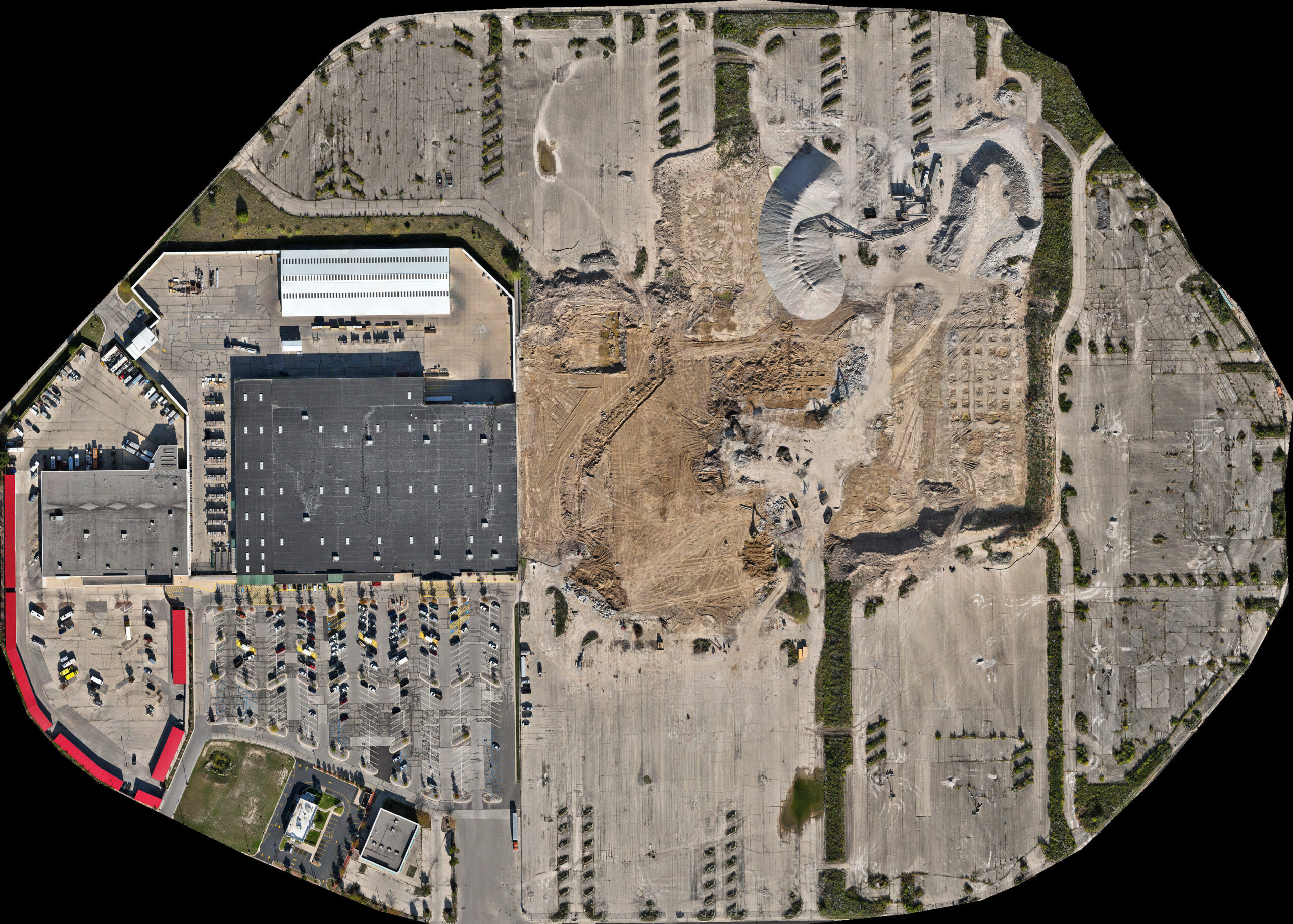
Orthomosaic Mapping
High-resolution aerial imagery processed into a measurable site map for documentation, planning, and project communication
View Example
02
Terrain & Elevation Products
Ground models, contours, slope maps, and hillshade products generated from processed drone data and GIS workflows
View Example
03
Interactive Project Viewer
Browser-based project access allowing clients to pan, zoom, inspect imagery, and review mapped site conditions without specialized software
Open Viewer